Weather & Smoke
Weather
Review the weather before and during a prescribed burn. A weather site with access to a point forecast (general forecast within a smaller area) and a fire weather forecast are both necessary.
Several days prior to burning: Review the long-term general weather
One or two days before the burn: Review the fire weather and spot forecasts
Day of the burn: Review the fire weather and spot forecasts; Obtain a spot forecast for your exact location by calling the National Weather Service Forecast Office for your area.
- Review general weather and point forecasts at the National Weather Service
- Review fire weather at the National Weather Service Fire Weather website
Smoke Tools
Smoke tools should be used to predict the effects of prescribed fire smoke on smoke sensitive areas. The smoke screening tools combined with the weather forecasts help ensure that the prescribed burn is successful.
Useful smoke screening tools:
Demonstration: Simple Smoke Screening
The Simple Smoke Screening tool allows the burner to compare different scenarios in order to choose the best day (in terms of wind) to burn.
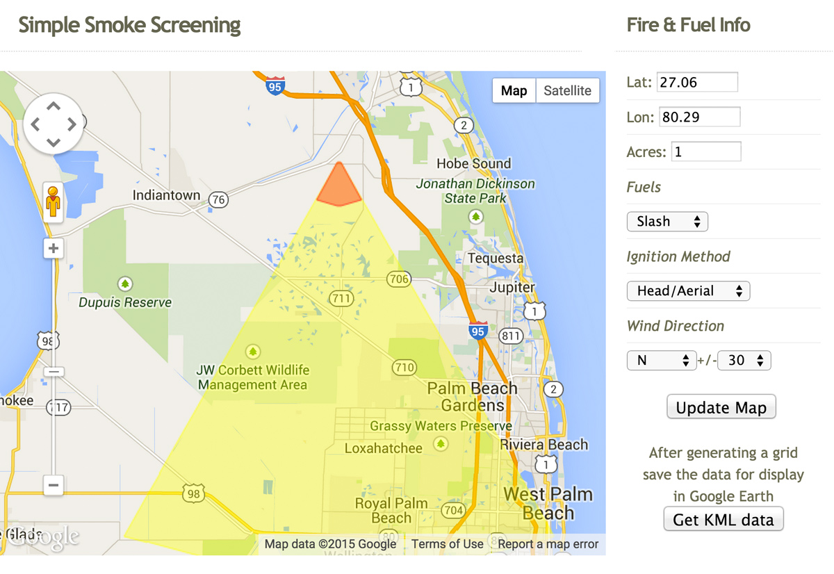
To use the Simple Smoke Screening Tool, enter the latitude, longitude, number of acres, fuels, ignition method, and wind direction. Then click “update the map.”
First let’s burn one acre of slash with a head ignition and a SW wind. The result shows that we are expected to spread smoke across Interstate 95. Smoke on roads is not a good situation.
Now let’s change the wind direction to a steady north wind. By changing the wind direction, the result indicates that the same location, acres, fuels, and ignition method is not predicted to spread significant amounts of smoke onto major roads.
See the results shown in the sample screenshot below.
To manage smoke during this prescribed burn, plan for a day with a steady north wind.
The Simple Smoke Screening tool is a great safety tool.